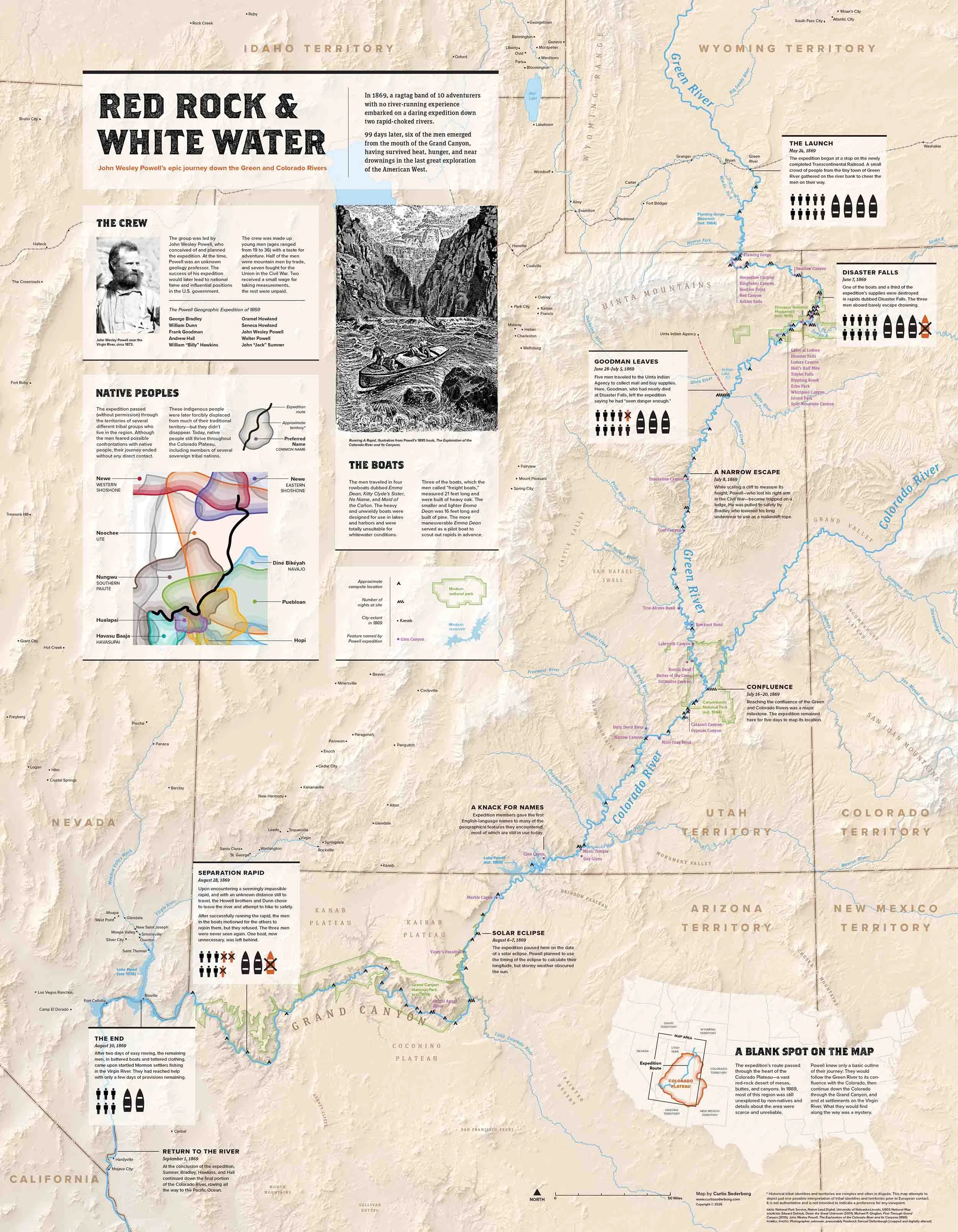
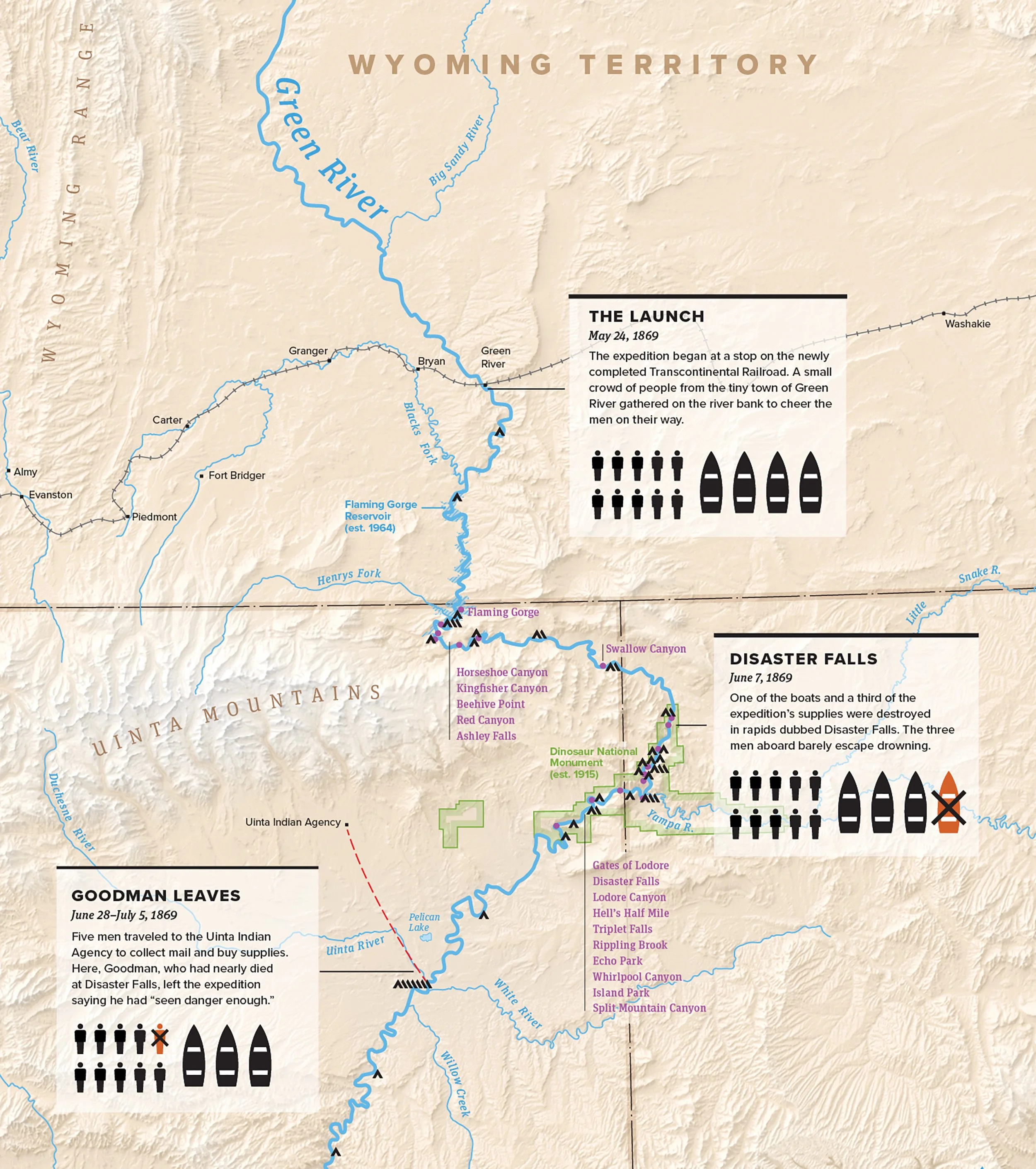
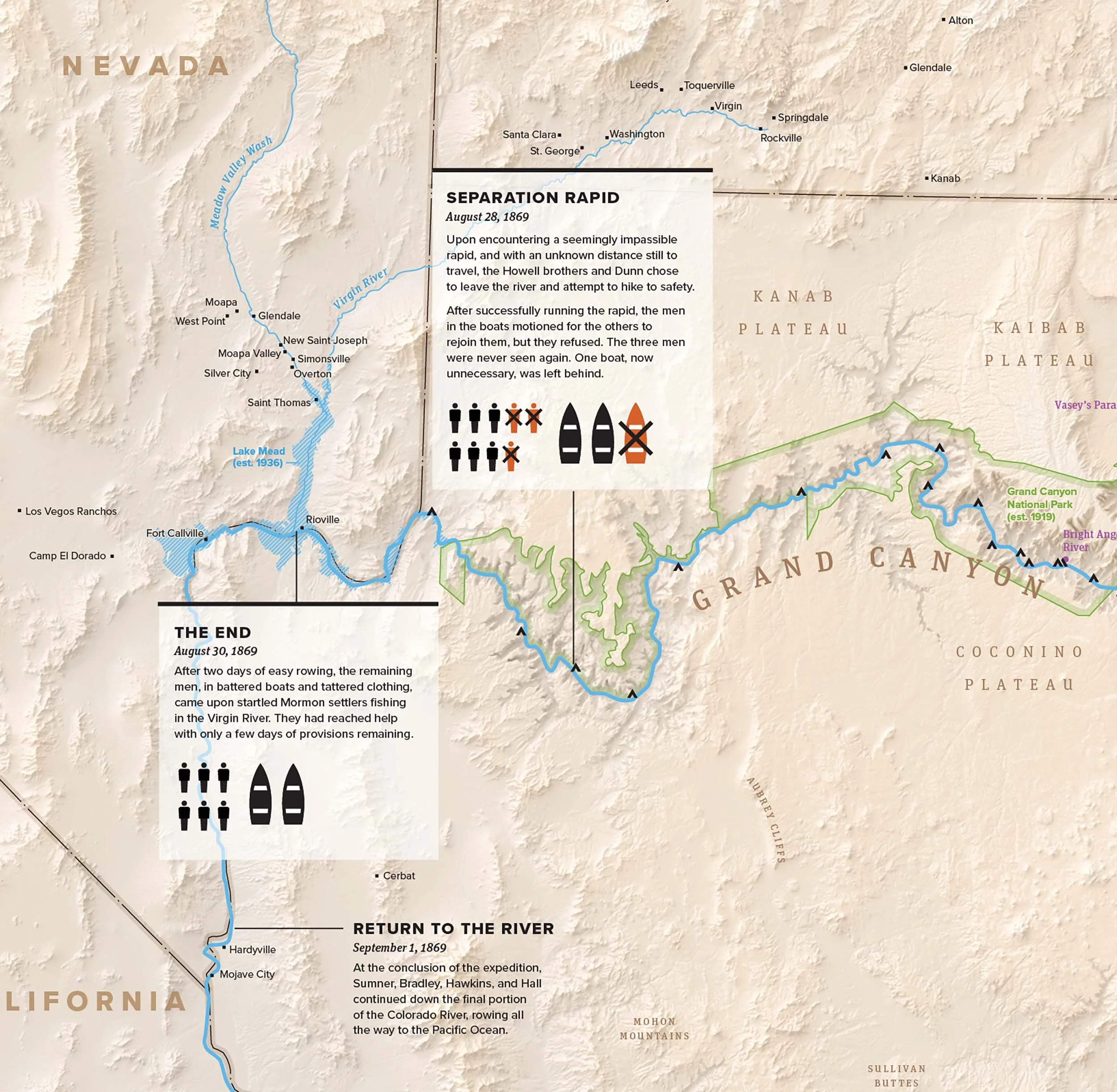
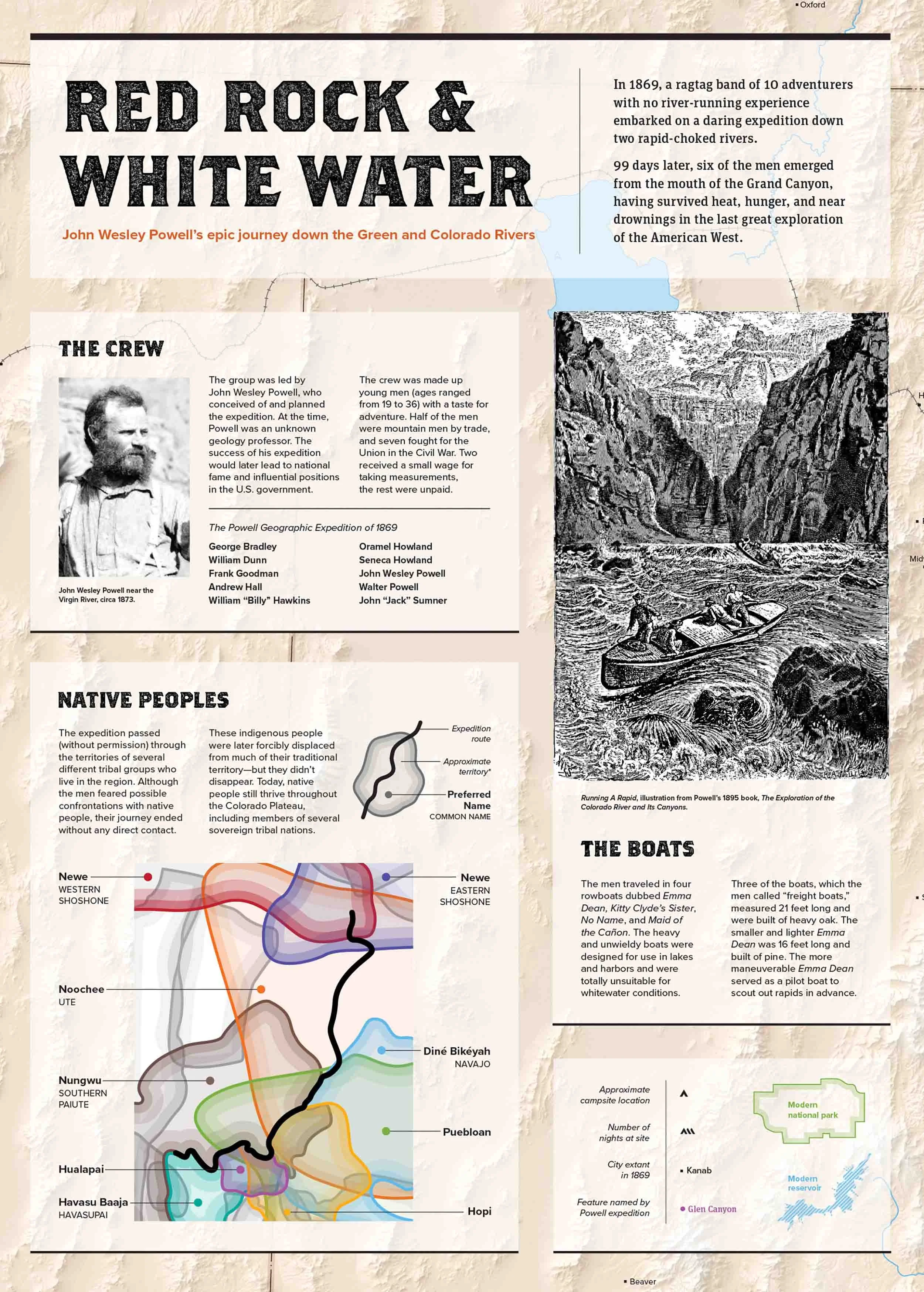
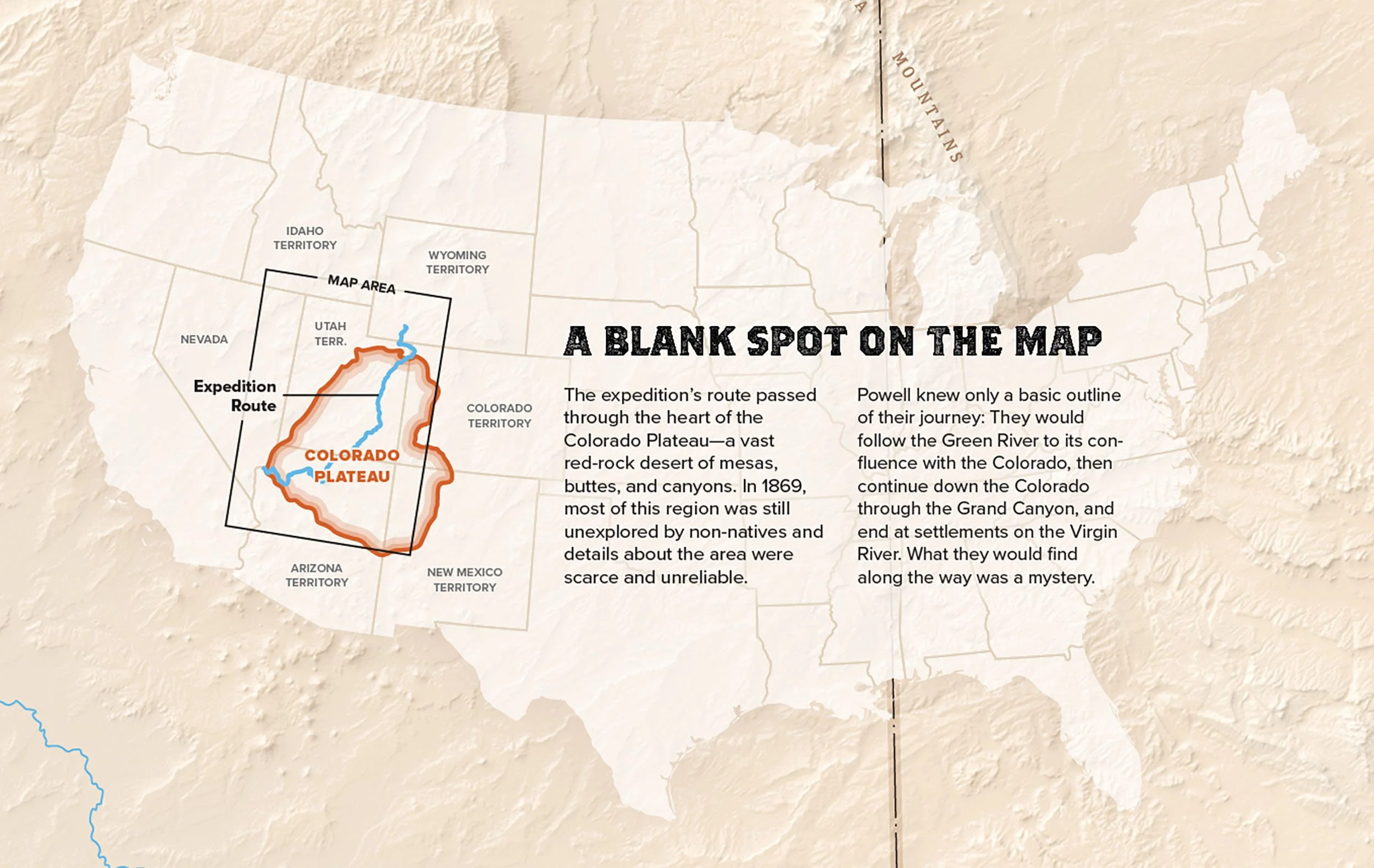
Poster map depicting John Wesley Powell’s 1869 expedition down the Green and Colorado Rivers.
Cartography, research, and text by Curtis Soderborg.
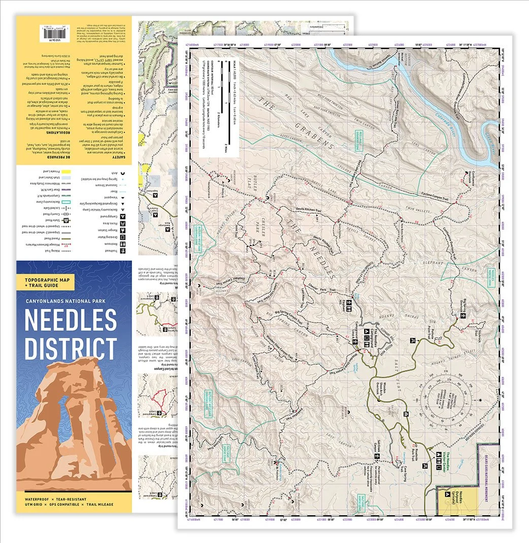
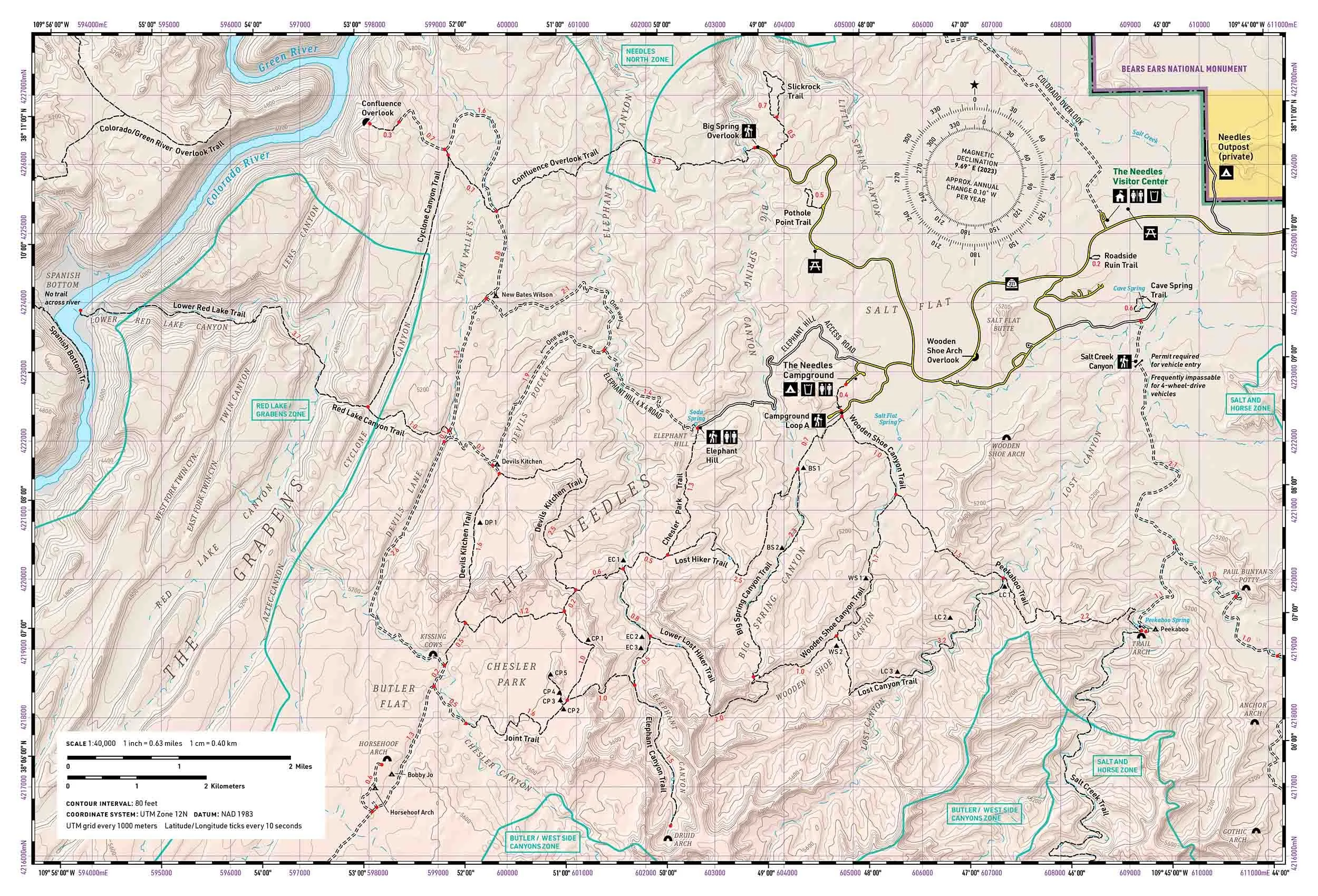
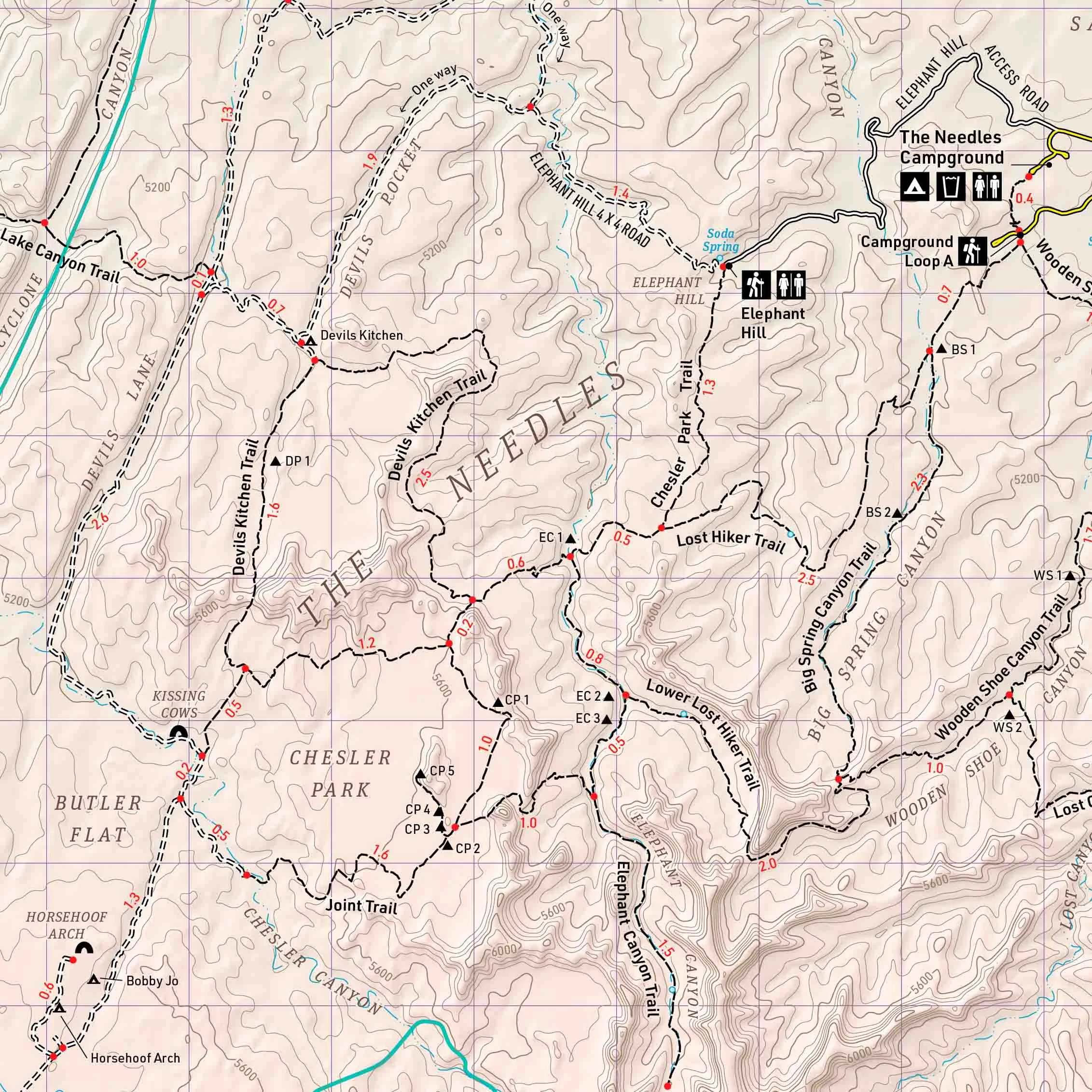
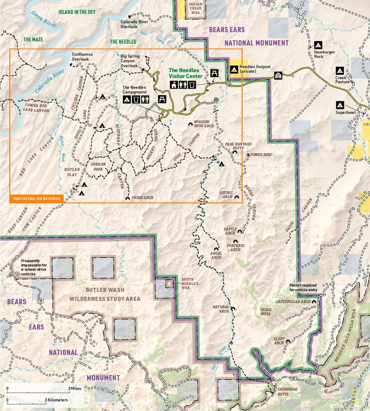
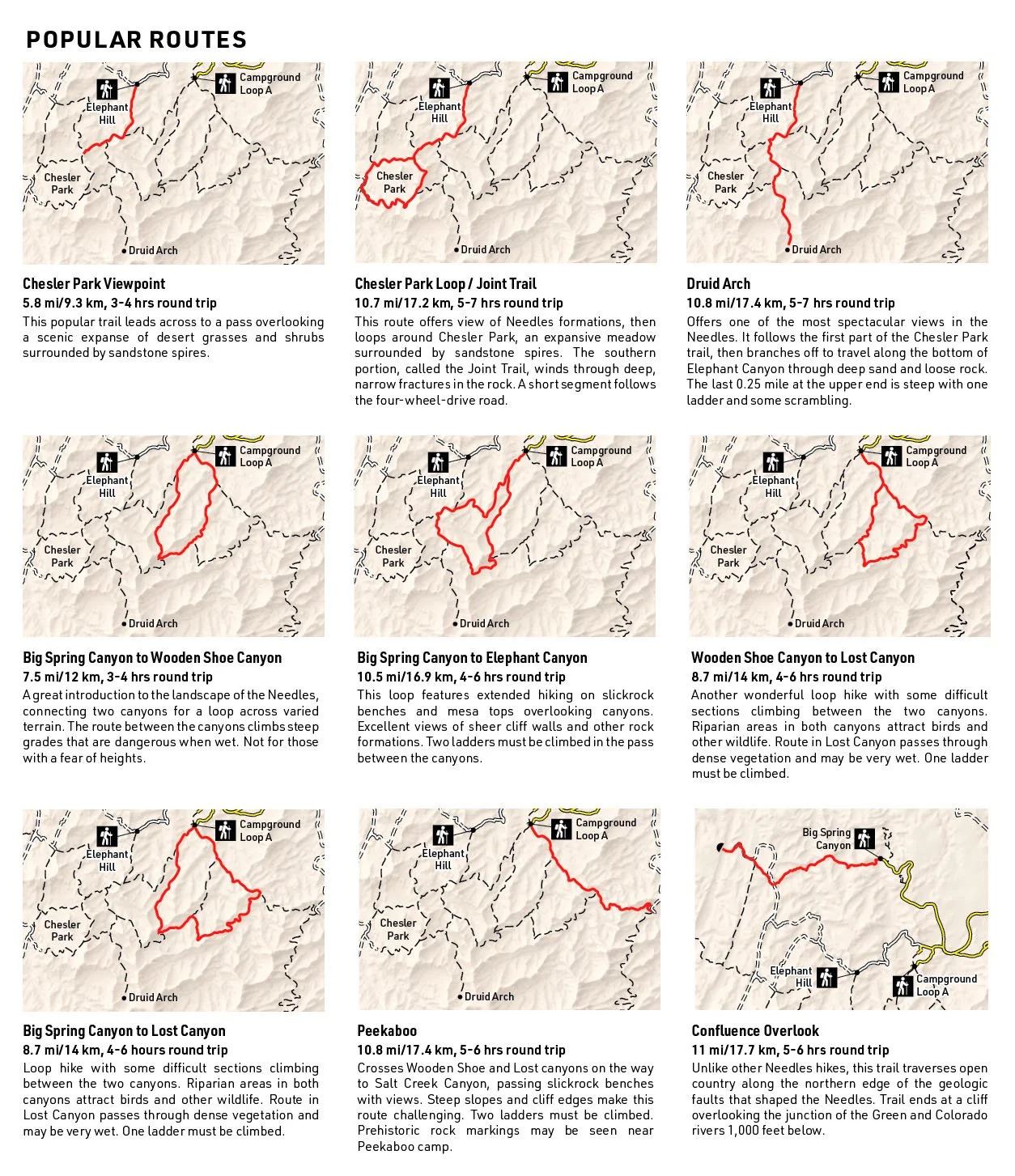
Trail map of the Needles District in Canyonlands National Park. One side of the map is a detailed view of the most popular trails in the area. The other side of the map features an area map to provide context and small maps describing popular routes.
This map was designed to be used by casual hikers and backpackers who stick to the most popular trails. The map is 1/4 the size of a typical trail map, while still depicting terrain at a more detailed scale.
Cartography and illustration by Curtis Soderborg. Text adapted from National Park Service website.
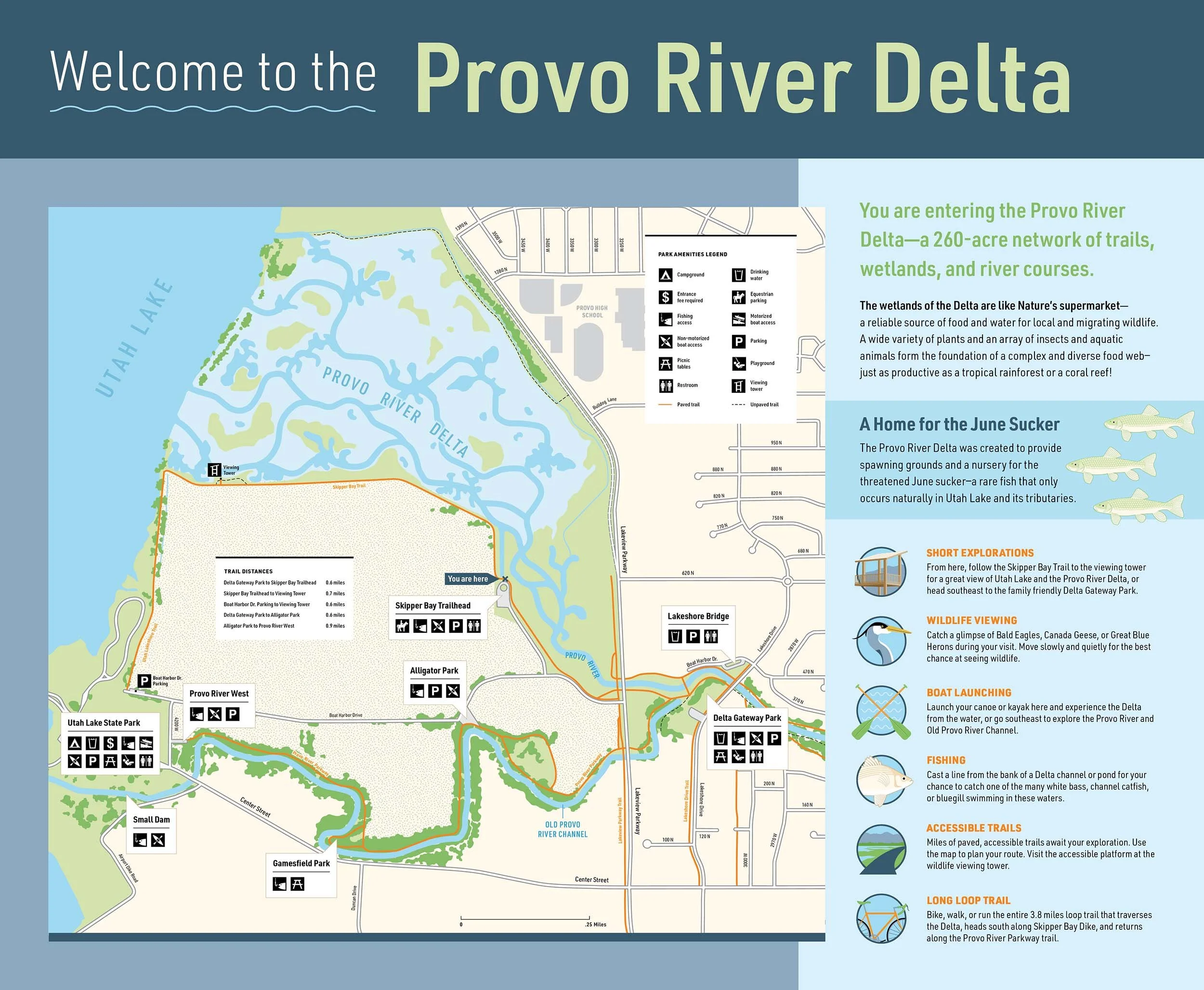
Wayfinding map for the Provo River Delta.
Cartography and illustrations by Curtis Soderborg. Text adapted from existing materials by the June Sucker Recovery Implementation Program.
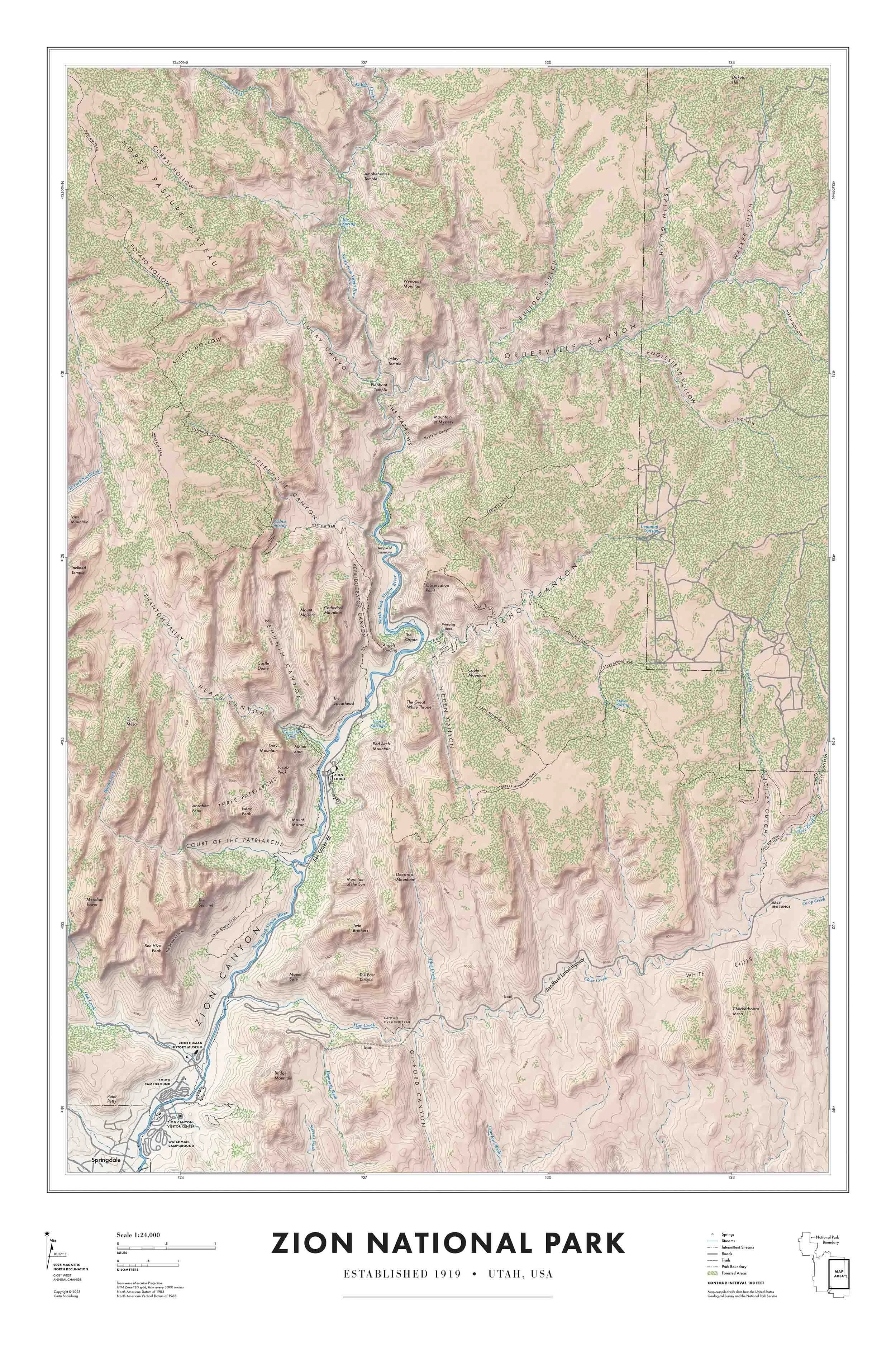
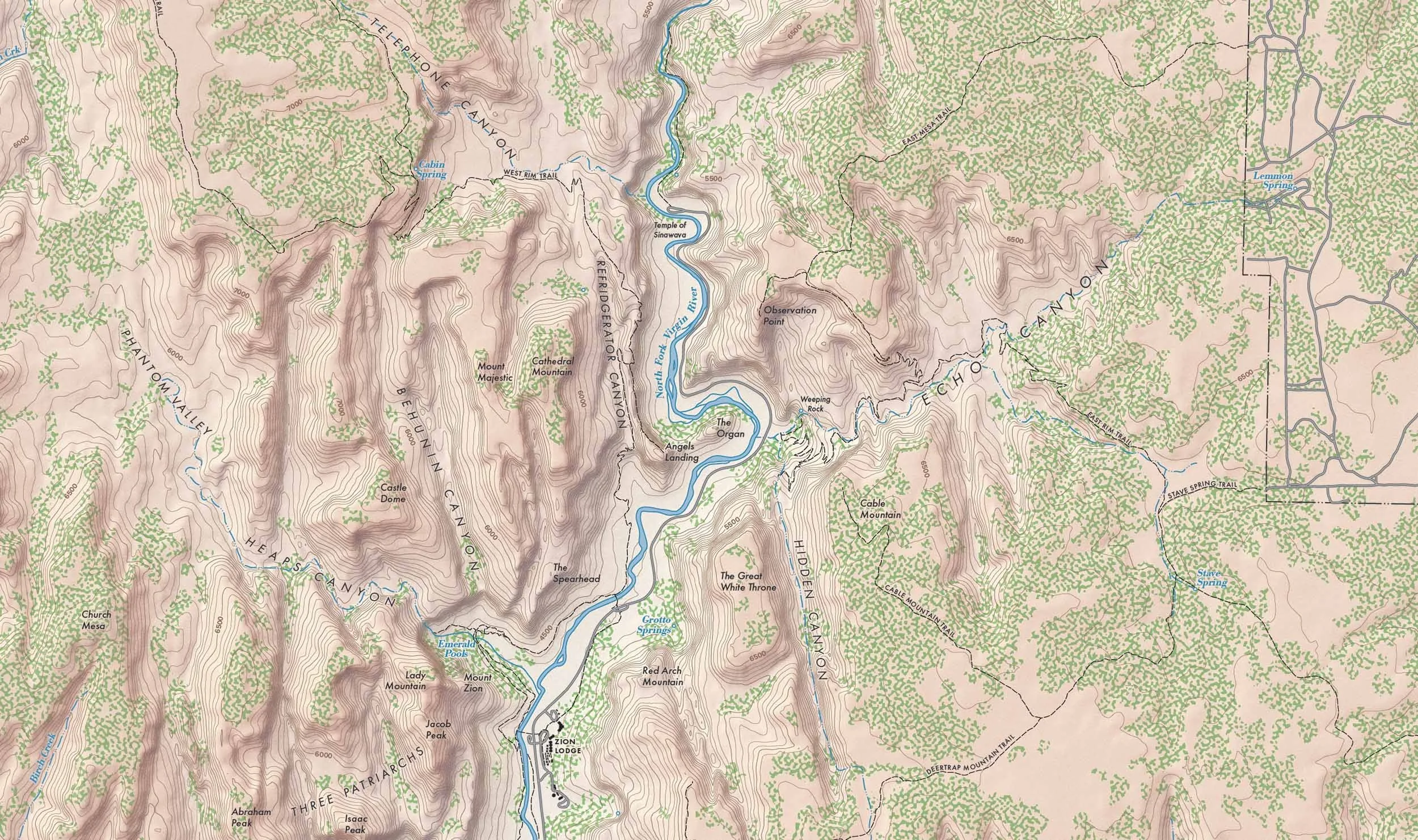
Wall map of Zion National Park in classic style.
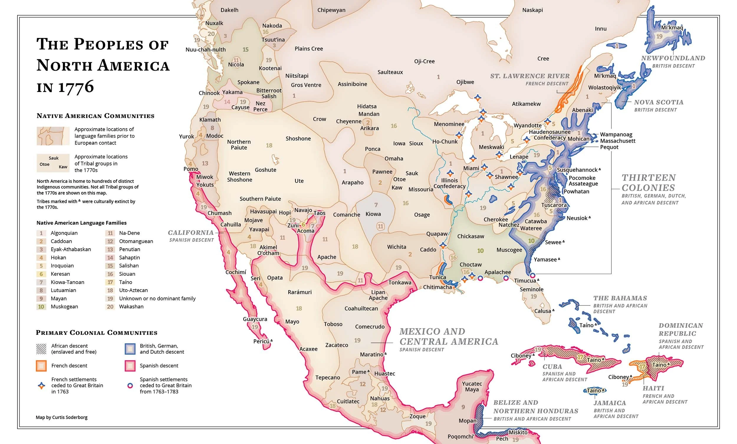
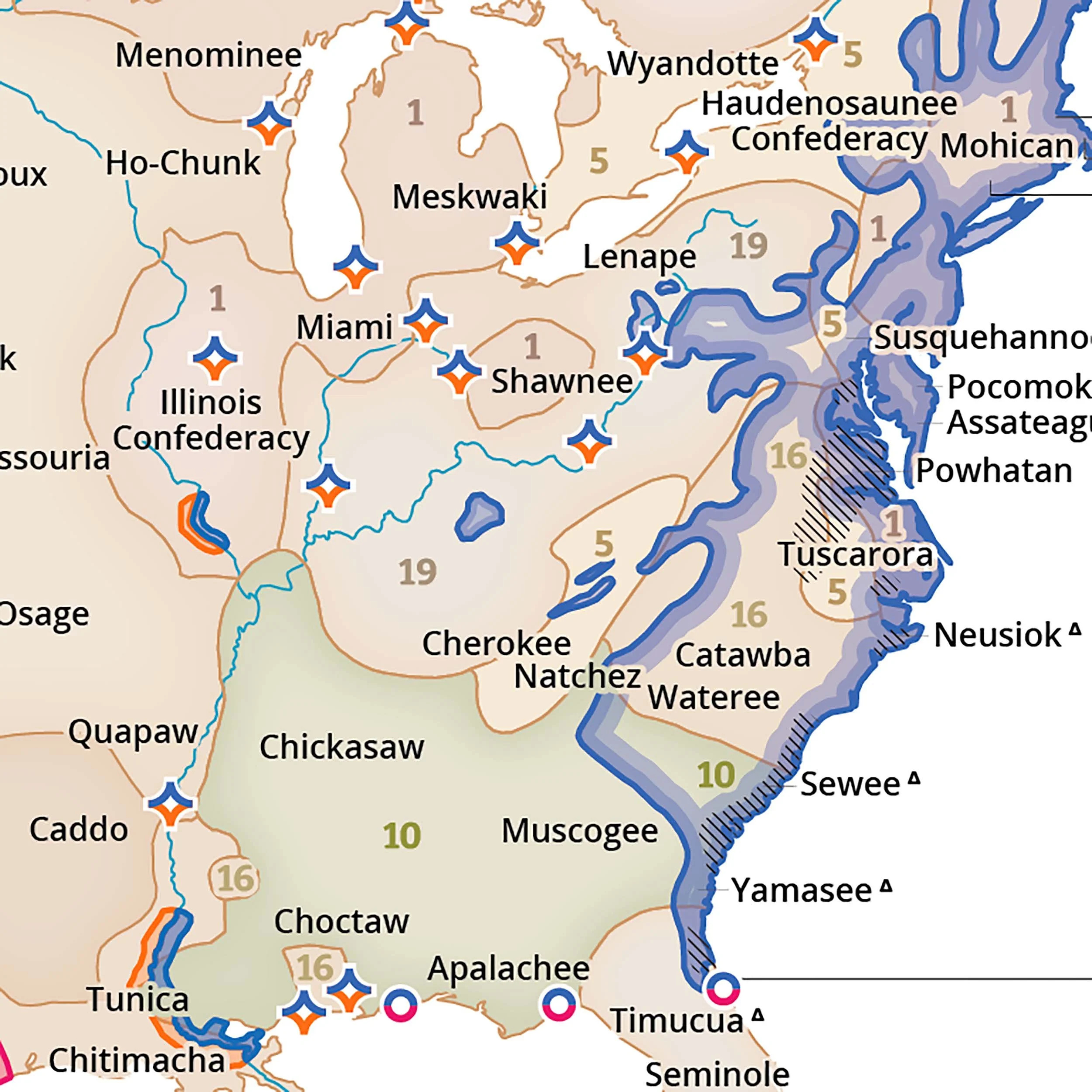
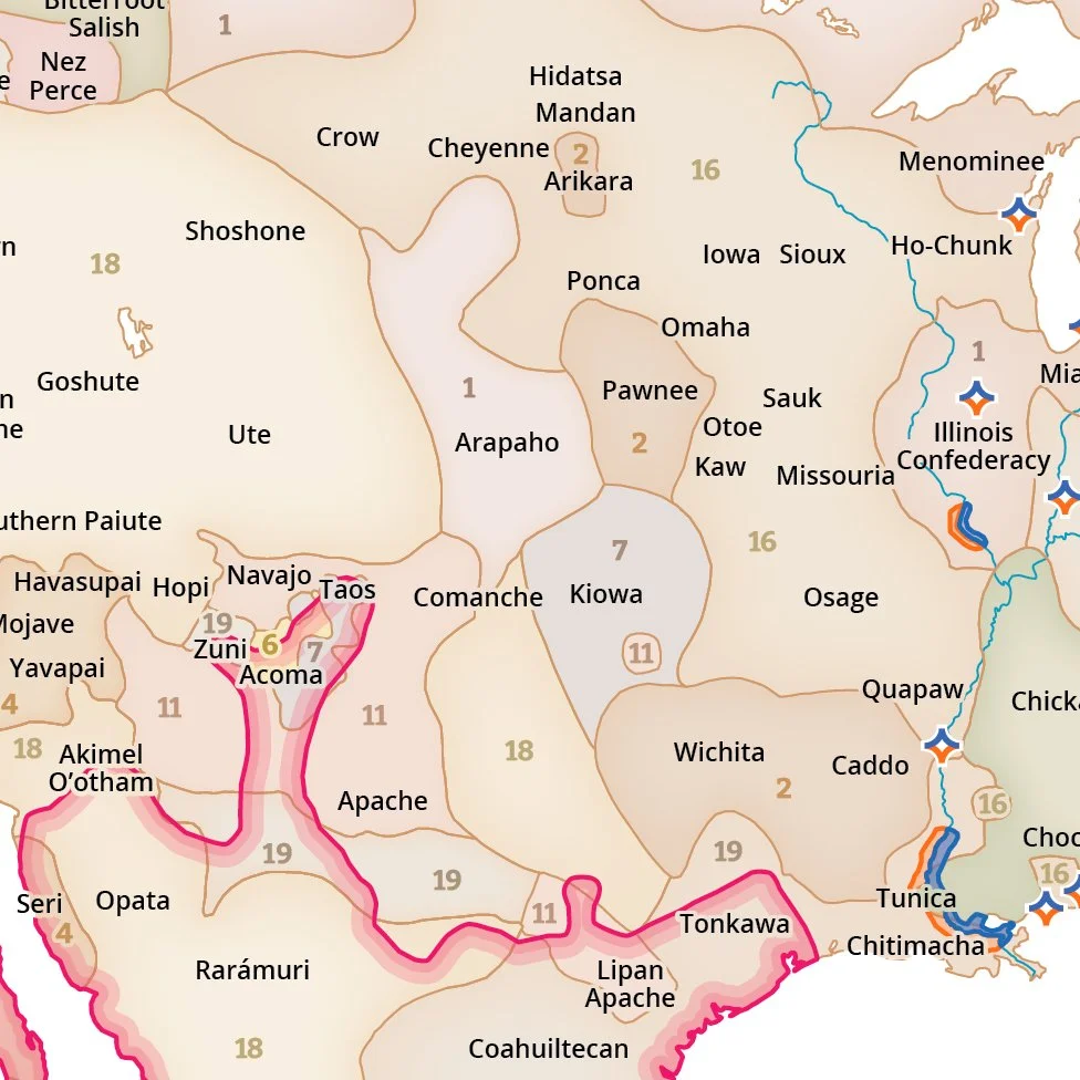
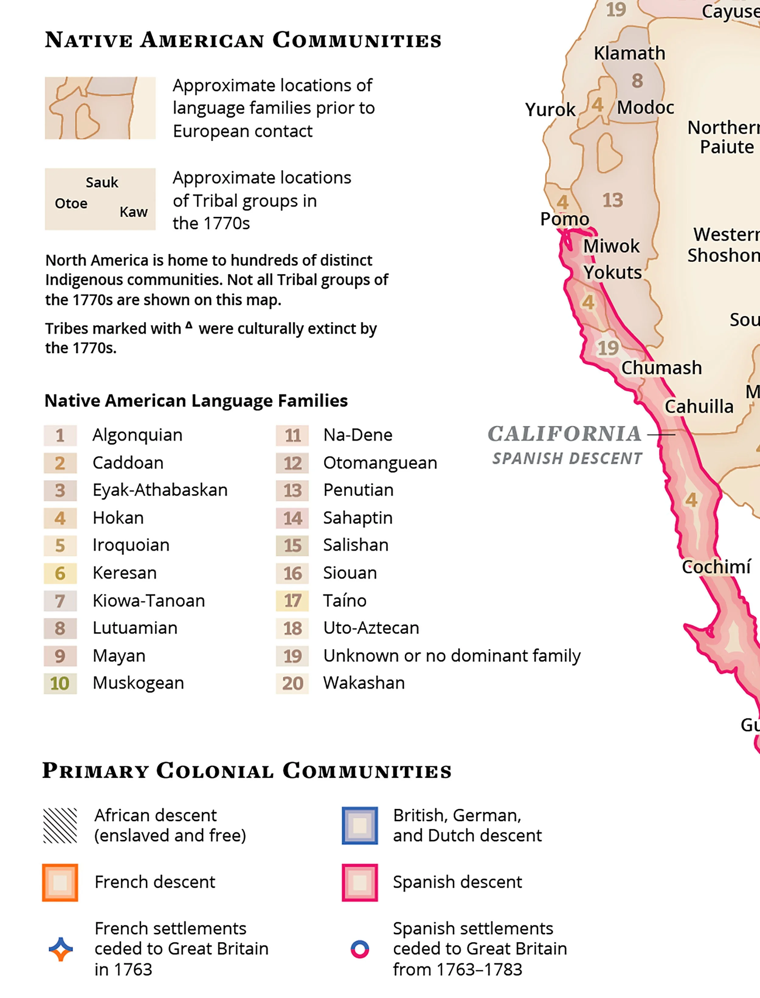
Map depicting the Native peoples and colonial groups in North America in 1776.
A version of this map was created with the Utah Historical Society as part of the America 250 commemoration of the signing of the Declaration of Independence.
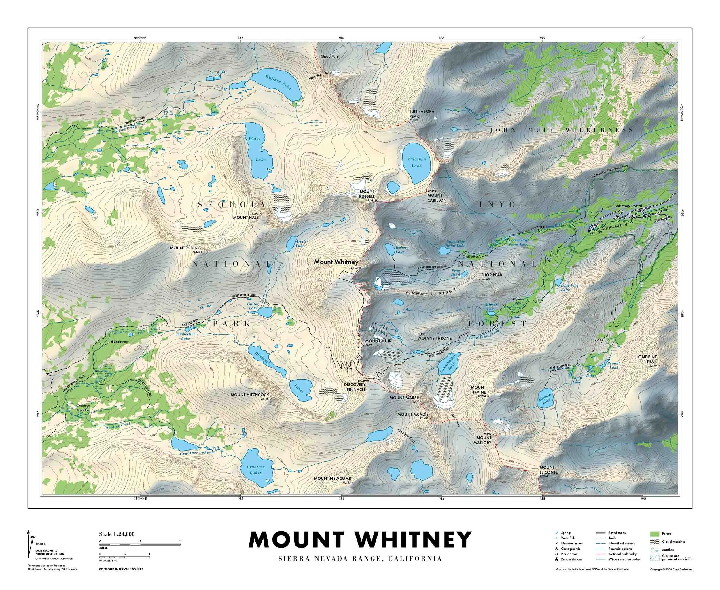
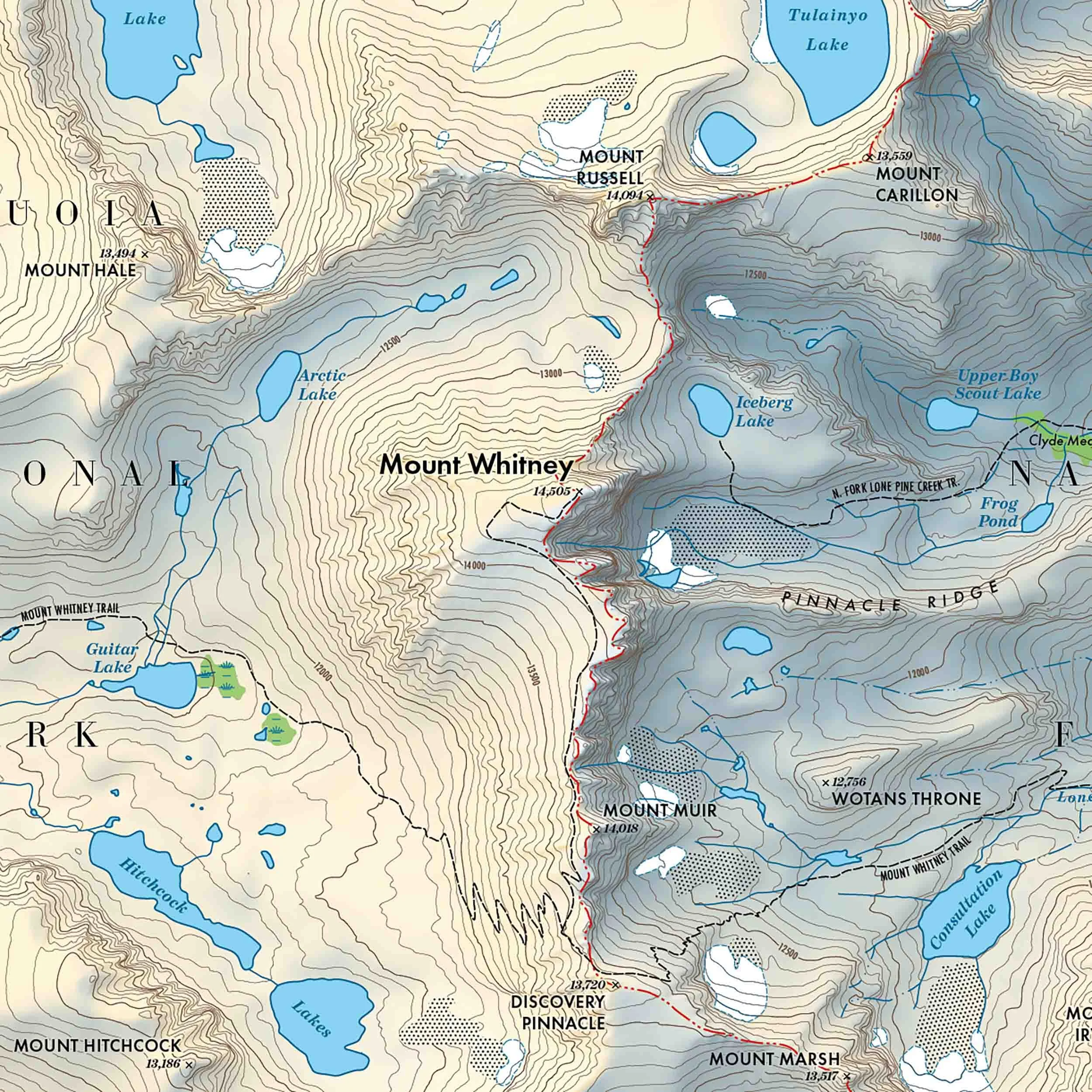
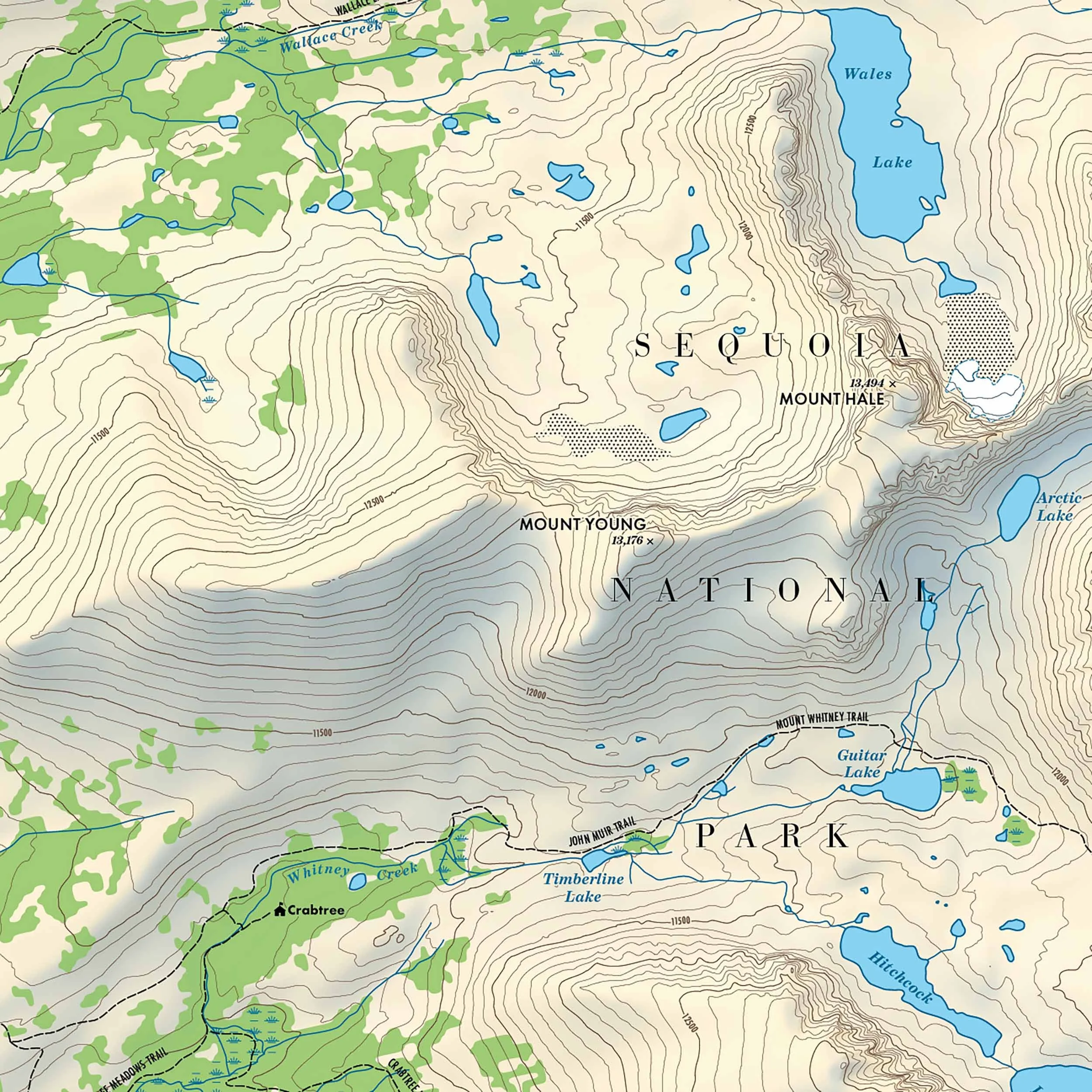
Topographic wall map of Mount Whitney.
Maps created for a research project at Weber State University.
This study measured threats to the wilderness quality of “extraordinary opportunities for solitude” in the Mount Timpanogos Wilderness Area by mapping the signs of human activity during the summer of 2022.